
Col de la Colombière
This is the biggest Alpine climb close to Geneva that one can reasonably aim to get out to and back from in a day’s ride. And what a beast it is.

Early morning Voie Verte
Our day starts beside the flower clock in Geneva, a typical meeting for many rides heading out on the Rive Gauche. We’re quickly onto the Voie Verte, the walking and cycle path that connects Geneva to Annemasse in France. This connection has made a real difference to getting into and out of the city and carries hundreds of cyclists a day, many of whom would have previously driven into Geneva.
We’re going far beyond Annemasse today and be sure to follow this route to get through the French town, as I have lost count of the number of times I’ve got lost trying to navigate through here.

Early Alpine views
The road gets quieter as we cross the Menoge river and we’re soon getting great views of the Alps in the distance.
We pass through Nangy and continue south-east following the Arve valley. The big town we’re heading for is Bonneville, in the shadow of Le Mole, where we cross the river and head for Marnaz where the climb starts with a bang!

14 tough km to go
The entire climb of the Col de la Colombière from Marnaz is 15km at an average of 7.2% but the first kilometre is very steep, averaging over 9% with stretches above 14%. Around now I’m normally glad I’ve had the long warm up from Geneva rather than hitting this cold.
The first half of the climb is shaded by woodland, and after the initial severe slopes, settles down into a nice gradient of around 6%. The road winds its way up to the flase flat that announces your arrival in Le Reposoir. This small village is home to La Chartreuse du Reposoir, founded by monks in 1151. Well worth a visit. Don’t drink too much of the liquor though – you’ve got more climbing to do.
The final 7km of the climb start as you leave the village and once you’re through the 4 early hairpins you can see your goal in the distance. The only problem is that you’ve still got around 4km to go, with the final 2.5km being above 10%. I’m really not a fan of these climbs that leave their steepest sections to the end!
The stunning landscapes take your mind off the slow progress as you inch your way closer and closer to the col. The road wiggles its way to the top and you have to dig in on the final kilometre at 10.4%. Enjoy a drink at the café on the col before heading down the other side.
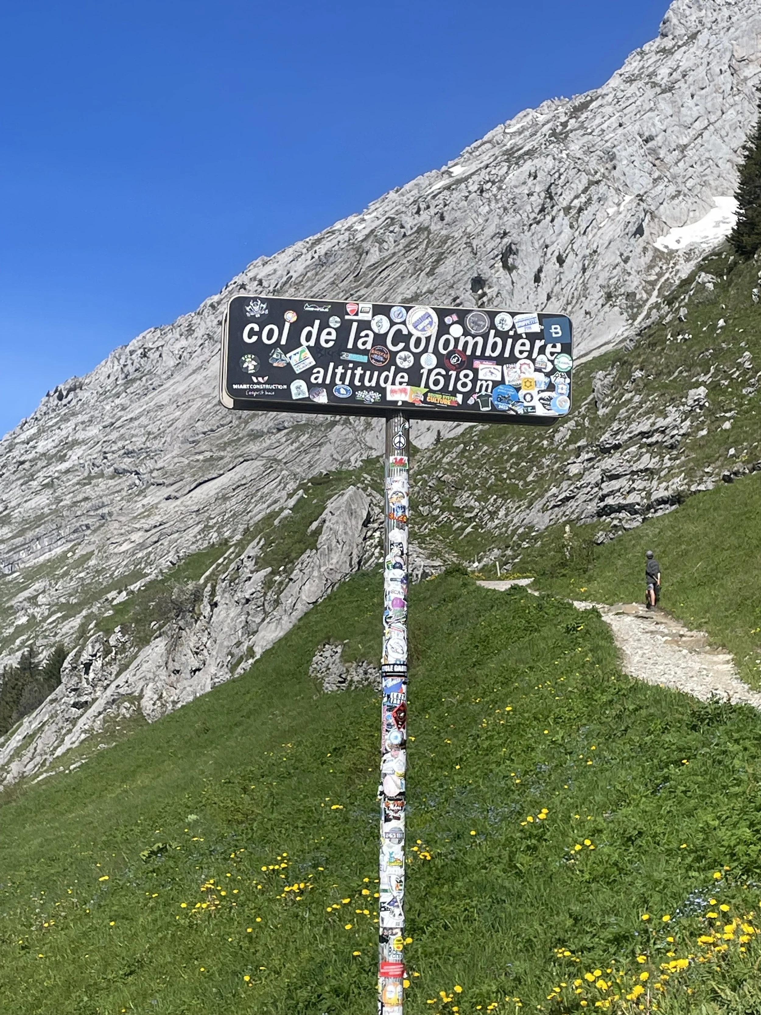
A well stickered col sign
The descent is wonderful, with great visibility, nice wide hairpins taking you all the way down into Le Grand-Bornand. From this alpine ski town there’s a brief uphill before you turn just before Saint Jean de Sixt and head down the wonderfully named Borne river valley.
Part way down here there’s the turn for the infernally steep climb to the Plateau des Glieres, but today we just keep spinning the pedals downhill, between the cool canyon walls that surround the lower part of the descent.

Saint-Pierre-en-Faucigny
The road pops you out just before Saint-Pierre-en-Faucigny and the route takes you just above the town to get over to La Roche-sur-Foron from where we’re pretty much on the home stretch.
You’ll now have the Salève in your sights and the road home takes you around the north-eastern tip and back into Switzerland at the Veyrier border.
The Swiss bike paths will guide you back into the city centre and back to the lake, where you can grab a well-earned cold drink!
Col de la Colombière – a taste of the high alps from downtown Geneva.